Skip to content

drone apps

August 28, 2019March 23, 2019
Screenshot of the AirMagic drone photo editing software in action, showing before and after slider

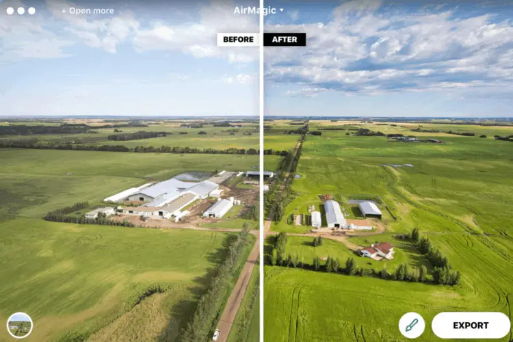
When we came across the AirMagic software a few weeks ago we were pretty skeptical. Most of these types of software are pretty basic in functionality and typically have lackluster … Read more

Tags aerial photography, aerial photos, drone apps, drone photo editing software, Drone Software Leave a comment
August 7, 2020September 11, 2018
UAV and drone mapping apps for surveying

Looking to do a basic elevation map of your farm to assess drainage patterns? Wanting to measure the volume of a gravel pile with your DJI Phantom? Needing to generate … Read more

Tags drone applications, drone apps, Drone mapping, drone maps, Drone Software, Mapping with drones