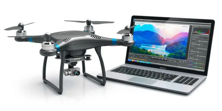
Over the past decade drones have rapidly gone from ultra-niche to mainstream, and the technology shows no signs of slowing down.
With the rise in popularity has come an increase in attention from software developers looking to add functionality to existing UAV platforms and ultimately sell apps and drone software to end users.
We have compiled a list of drone apps that can be used for anything from building sophisticated waypoint missions, to assessing the magnetic interference at a flying site, to counting cattle on a farm.
(Note: Don’t yet have a drone? Visit DroneTrader.com to browse new, used, and specialty drone listings in your area!)
List of Interesting Drone Apps & Software (Updated September 2021)
AirData
AirData has rapidly grown into a household name in the UAV industry. It integrates tightly with the DJI and Yuneec brands of drones, and provides valuable information for drone pilots such as battery life and health, complete flight logs, flight archives and more.
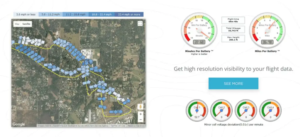
The AirData app has proven to be an excellent tool for UAV pilots around the world, giving operators a very intuitive way to view the “nitty-gritty” data available from their drones and drone batteries.
At the time of this writing they have had close to 7,000,000 flights uploaded to the platform and close to 100,000 users!
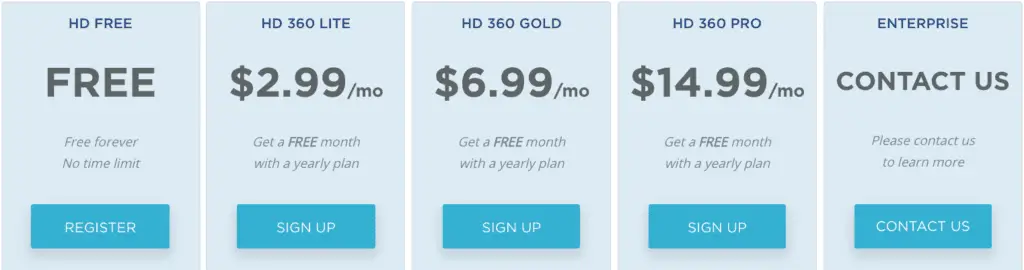
AirData offers a host of different pricing plans, including a free account for users to trial.
The AirData app is available on both the App Store and Google Play.
AirMagic
AirMagic is AI powered photo enhancing software specifically for aerial photos that is incredibly intuitive. It gives users just enough control over the edit without being too confusing.
For those that find the pro-level apps such as Adobe Lightroom or Adobe Photoshop too daunting, AirMagic is the perfect solution. With it’s simple drag-and-drop interface and intuitive export menu, users will immediately feel comfortable using the AirMagic software.

Read our more in-depth review of the software here: http://blog.dronetrader.com/airmagic-photo-enhancing-software-a-comprehensive-review/
DroneTrader Classifieds
The DroneTrader app was built to accompany the DroneTrader.com Classifieds network to make it even easier for users to list their used, specialty or custom UAVs and drones.
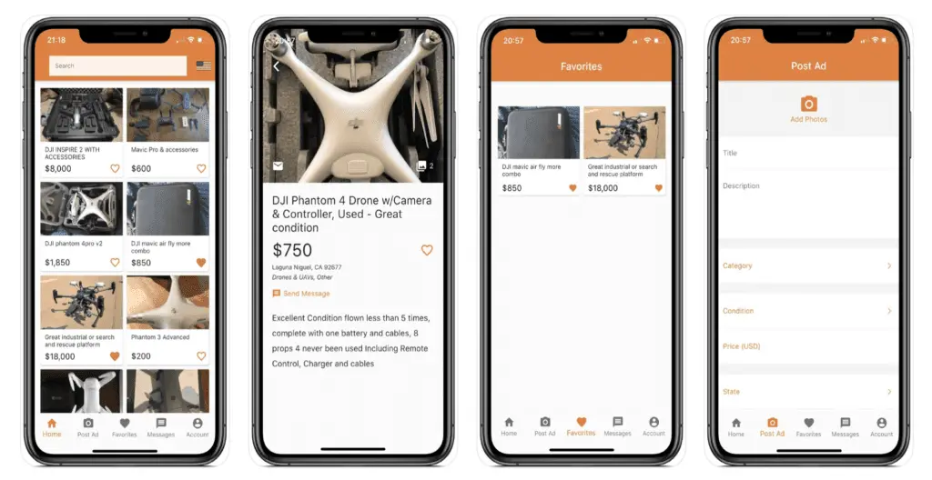
The app allows users to easily generate an ad from their smartphone, message sellers directly via the app, save ads to their favorites and much more.
Download it for iOS or Android!
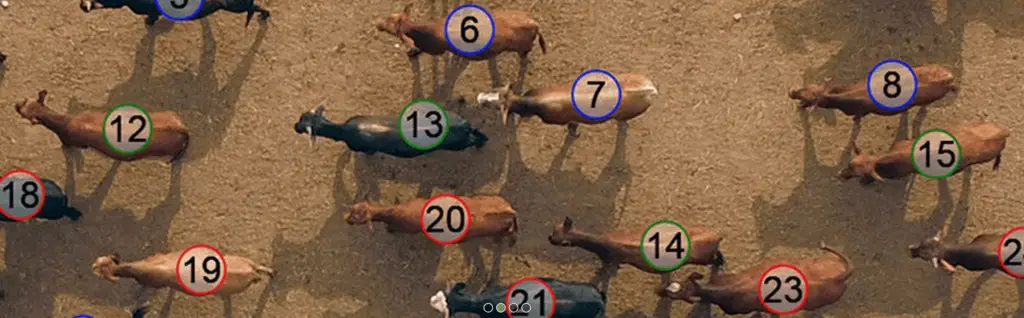
COWculator (by Quanterra)
COWculator is ultra-niche UAV software built specifically for counting cattle in large farming operations. COWculator claims 99% accuracy in their counts.
Pricing is relatively inexpensive compared to some of the other options, and the process appears to be almost completely automated. It is “drone agnostic” which simply means that photos from almost any UAV can be used with the software.
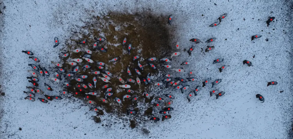
This software is an excellent option for farmers, bankers, insurance adjusters etc that are looking to quickly and accurately count large amounts of livestock.
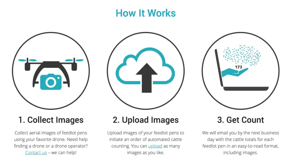
The company currently offers a free trial of the software, with some affordable pricing options for users who have completed the free trial. Learn more at https://www.quanterrasoftware.com/services/cowculator-automated-cattle-counting/
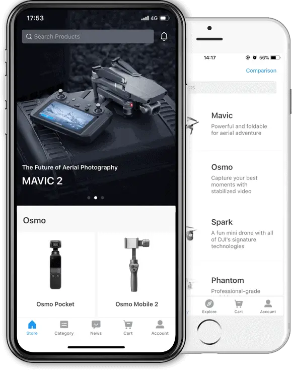
DJI Store App
The DJI Store app allows users to quickly navigate all the products available in the DJI Store, view previous orders, and put in requests for service, all from your Android or iOS device.
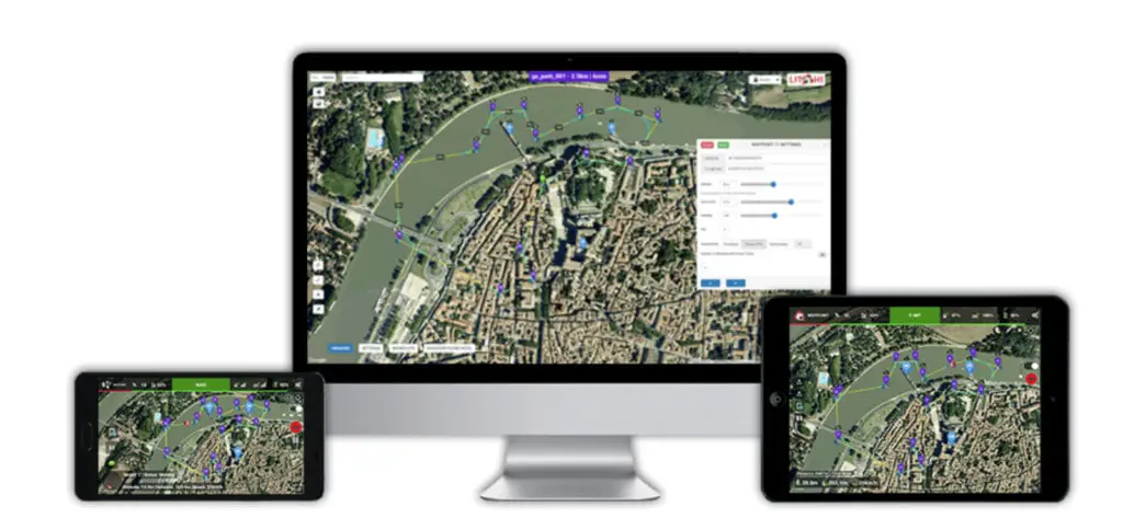
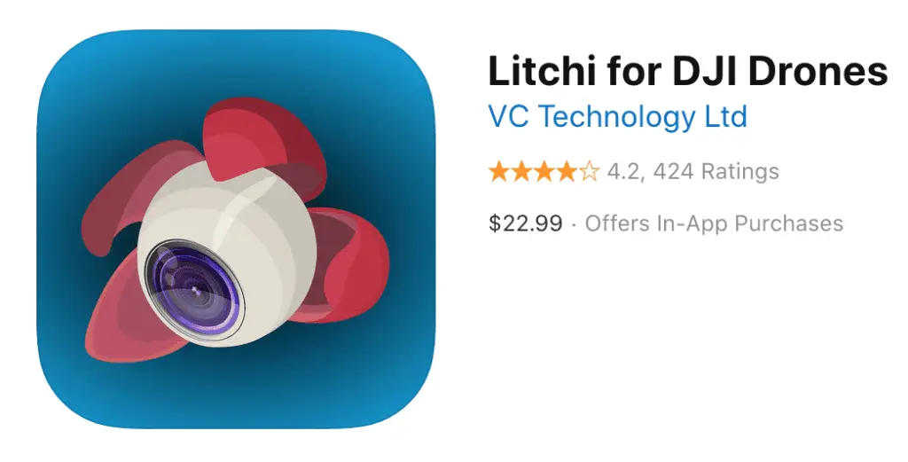
Litchi
Litchi is one of those apps that once you have it, you don’t know how you did without it.
One of the original uses was to add object tracking functionality to the DJI drones that did not have it however it has since expanded into an extremely versatile drone control center.
It boasts features such as Panorama, Orbit, Follow and more. It allows users to setup complex video and timelapse sequences that can be saved and repeated for future flights. The Litchi waypoint mission engine is nearly unmatched in terms of flexibility and intuitiveness.
Although great for recreational users, it really shines when used for commercial projects such as construction site monitoring, aerial timelapse progress reports and more.
Commercial operators that do weekly construction site flyovers will quickly realize the benefits of having a fully automated, repeatable flight path time after time.
Litchi also now offer a Mission Hub which allows users to view missions that are being flown all around the world.
Litchi is available on both the App Store and Google Play.
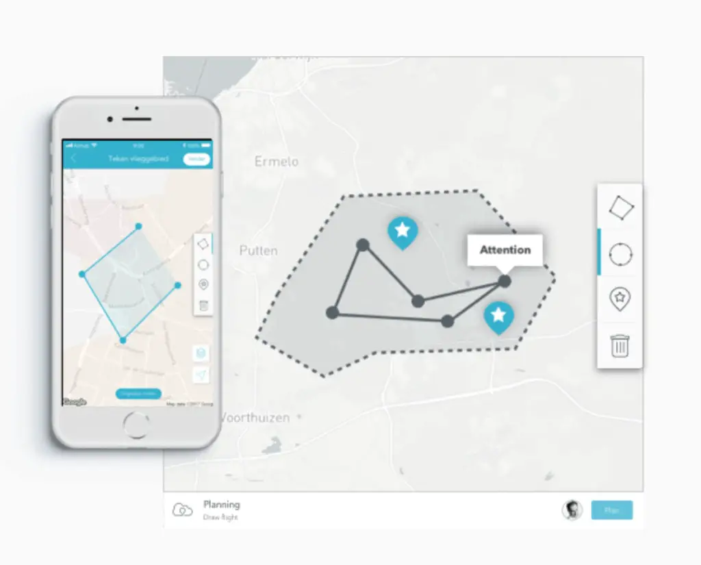
DroneSAR
DroneSAR (Drone Search-and-Rescue) is an app developed specifically for DJI UAV operators that use their drones for search and rescue.
The app allows operators to generate custom search grids, share specific locations with team members, fly waypoint mission and stream live video all over the world.
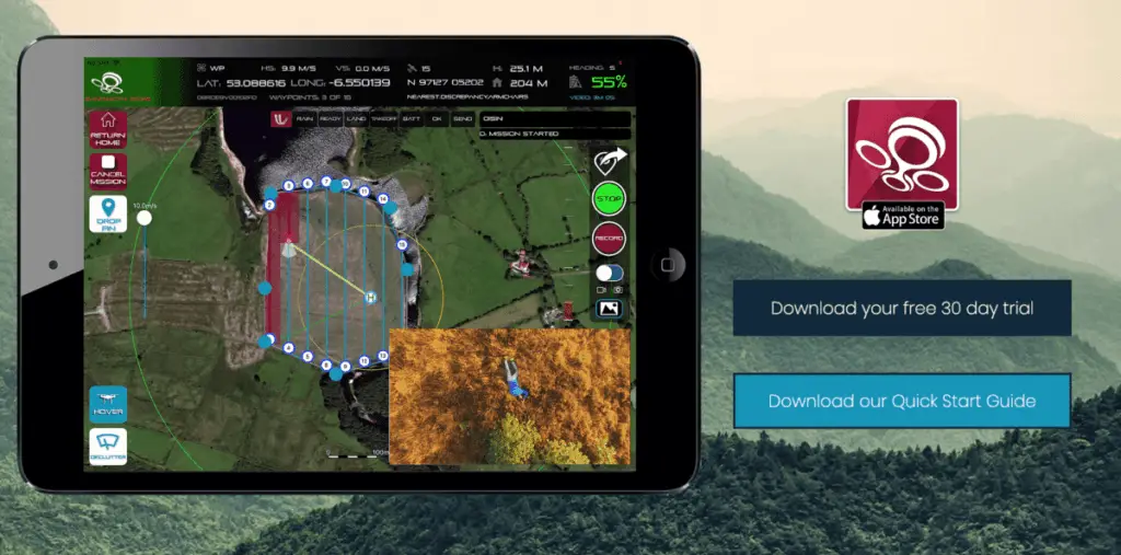
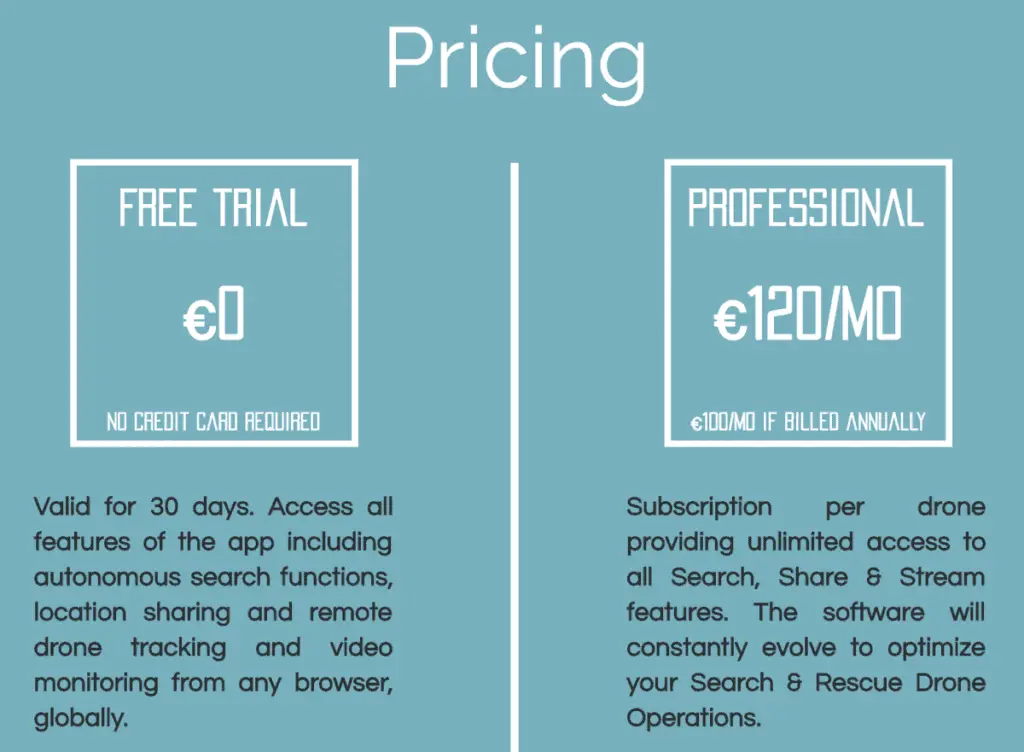
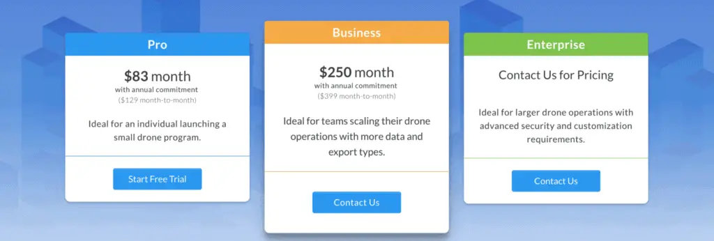
Based out of Dublin, Ireland, DroneSAR offers both a free trial for 30 days and a paid plan of €120/month.
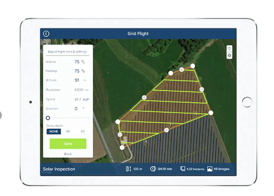
DroneDeploy
We discuss drone mapping apps including DroneDeploy in greater depth in a related blog post, but DroneDeploy is so versatile and intuitive for new and experienced drone flyers alike that it deserves another mention in this list.
DroneDeploy was one of the original mapping apps available for UAV operators and has a very streamlined interface and excellent 3rd party app store that significantly expands its capabilities.
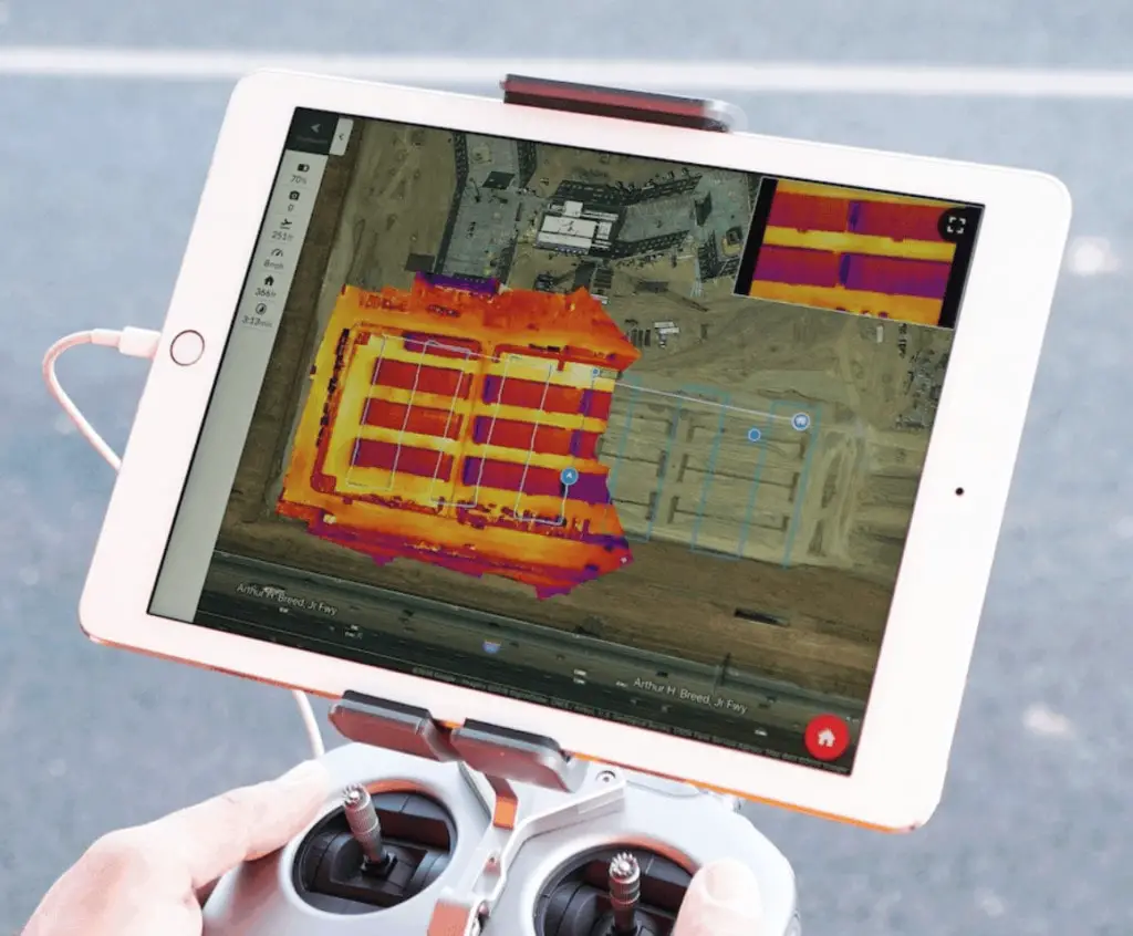
Whether you want to develop a digital elevation model (DEM) of an area of land, measure the volume of an aggregate stockpile, or develop large orthomosaics for future reference, DroneDeploy can do it. It integrates well with the DJI series of drones and is being used by thousands of operators across the world.
Wondering what DroneDeploy can do for you? Check out some of their case studies and whitepapers available on the DroneDeploy site.
The DroneDeploy app is available on both the App Store and Google Play.
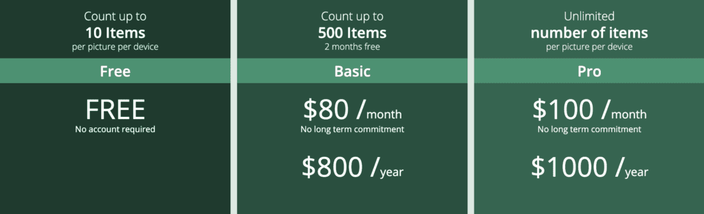
CountThings
CountThings is similar to COWculator mentioned earlier in this post, however it can be used to count a variety of objects, not just cattle or livestock. They claim to be able to accurately count log piles, pipe inventory and much more.
Pricing is significantly higher than previously mentioned COWculator, but they have native iOS and Android apps available and what appears to be more robust and fleshed out software.
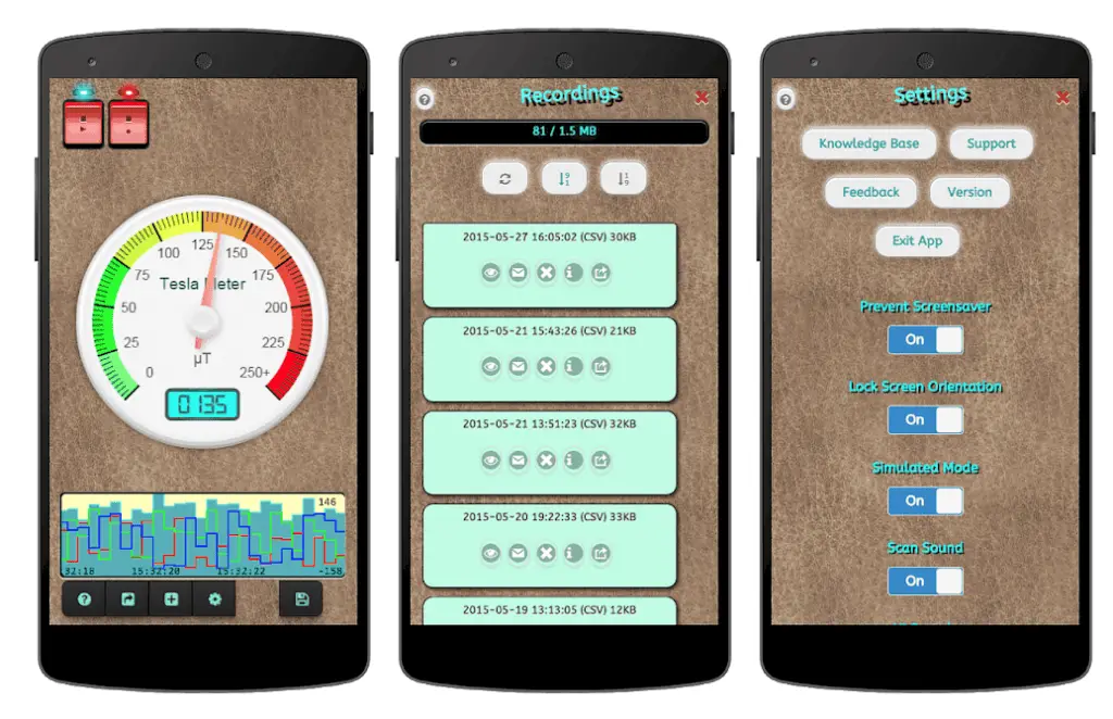
Tesla Magnetic Field Recorder
Although this app is not specifically for drones, it does make for an excellent companion to drone operators everywhere.
The Tesla app simply uses the built in magnetometer in your mobile device to detect magnetic fields nearby.
Almost every drone available on the market today relies on highly sensitive compass data to determine which direction it is orientated in and in which direction to fly when stick inputs are given.
The Tesla Field Recorder app eliminates guess work as to whether or not there may be a strong magnetic field in the area which may affect the accuracy of the compass readings and the accuracy of the flight operation.
It is available on both the App Store and Google Play.
Verifly
Drone insurance (which is increasingly mandatory for both commercial and recreational operators) is typically a large annual expense for UAV operators, especially those who only fly occasionally or who operate commercially on a part-time basis.
Verifly recognized this issue and was one of the first to market with “on-demand” drone insurance. With pricing starting at only $10, it is an incredibly affordable way to insure individual UAV flights.
The Verifly app is incredibly intuitive (4.9 stars on the App Store!) and uses location data to determine pricing. With liability coverage up to $10 million and underwriting by one of the biggest names in aviation insurance (Global Aerospace Inc.) they have coverage options for almost any operation.
The Verifly app is available on the App Store and Google Play.
(Note: we cover more UAV insurance options in our Drone Insurance Providers blogpost but thought that the Verifly app deserved an extra mention due to the value it provides and how well it integrates into any operation)

Autopilot
The Autopilot app by Hangar is often called “Litchi on Steroids.” Although Litchi has an intuitive and solid interface, the Autopilot app has an unmatched level of customization available for drone operators looking to operate outside of the confines of the DJI app.
It also allows for motion and object tracking, has built in preflight checklists, allows you to fly your drone via gesture control, supports formation flying and so much more.
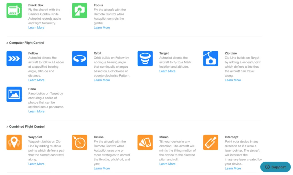
As it is such a highly configurable app some users complain that it is too advanced and incorrectly setting a parameter can lead to a crash.
However with some basic in-app training and careful setup of your flights, the Autopilot app is an incredibly powerful tool. Be sure to check out some of their use cases and customer videos demonstrating the unique abilities of the app.
The Autopilot app is currently available on the App Store.
Hangar 360
The Hangar 360 App does one thing, and does it well. The sole purpose of the Hangar 360 App is to take (and stitch together) aerial photos into a 360 degree interactive sphere.
Do you sometimes see the interactive photos on your Facebook feed that allow you to pan around the photo? The Hangar 360 app does that, but from 300′ in the air.
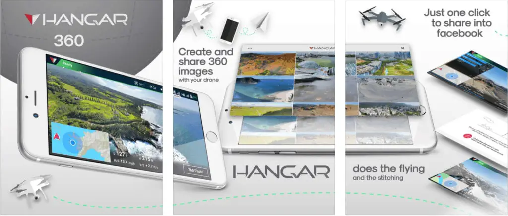
The app is completely free with no usage limits, and is compatible with a variety of DJI platforms. It is currently only available on the App Store.
DroneBuddy
The DroneBuddy app was built for pilots to quickly check local weather conditions, KP index (important for accurate flights), sunrise/sunset times and no-fly zones in their area.

It also includes data such as cloud cover, visibility and UV index levels. The app will quickly become a invaluable companion to recreational and commercial operators alike.
The app is available on the App Store and on Google Play.
AirHub
AirHub is a drone app designed to allow users to plan, control and record drone flights. It also displays information such as NOTAMs in the area, allows for team flight planning, DJI/UTM integration so your flight can be registered with local air traffic control and more.
The app is currently available on the App Store.
Ground Control
The Ground Control app by Measure (formerly AirNest app) is built for enterprise drone operations. The crew at Measure developed this app for large scale operations, allowing you to monitor thousands of drone operations in real time.
It also allows for remote flight updates and monitoring, and will notify users when a flight breaches safety protocols and includes semi-automated and automated flight options.
Pricing is not publicly available at this time. The app is available on the App Store.
Drone Logbook
The Drone Logbook app focuses on providing industry-specific flight logbooks. It specializes in providing logbooks for industries such as public safety, commercial operators, enterprise operations, manufacturers and more.
The have a wide variety of pricing options to cover any operation, from one-man-bands to giant enterprise solutions.
It has the ability to import flight and UAV data from over 40 different manufacturers, offers 3D flight playback, autoimport of flight data and much more.
For those looking to track and report on every available metric of their operations Drone Logbook has you covered.
Drone Logbook is currently available on the App Store and Google Play.
In conclusion…
The rapid rise in affordable drone technology has in turn led to heavy investment in drone apps and software by a wide variety of companies. It is becoming increasingly easy to add functionality to your UAV whether it is an entry level DJI Mavic or a top of the line Inspire 2 setup.
See an app not listed here that you would like to see featured? Reach us via our support page and let us know!